Egerton Walks
4 Walks around the village
These walks have been compiled to enable you to enjoy our village from different aspects.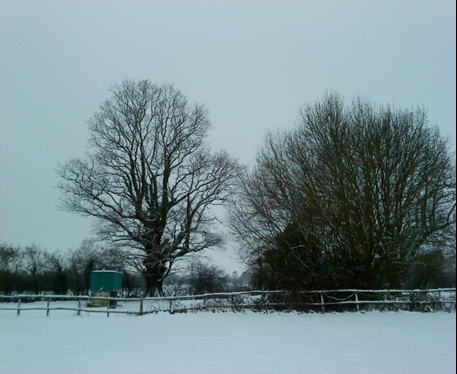 We hope you will appreciate that we use the footpaths through the courtesy of local landowners, who do their best to keep them in good order, so that we can access the countryside at our leisure. Please help us to support farmers in the course of their work by leaving no hazardous litter, closing all gates and keeping dogs under control at all times. Watch out for the occasional rabbit hole and slippery mud – walking boots are a bonus!
Click on the description for a pdf map.
| Walk 1 West of the Village Click For pdf
START: The Barrow House, Egerton From the Barrow House, walk northwards along The Street. You may wish to call in at the Village Store, on the right hand side, to purchase light sustenance for your walk. Turn left into the churchyard. Take a look inside St James’ Church. The tower dates from 1476 and contains six bells. The representation of the Good Shepherd in the window of the north aisle dates from 1906. The brass chandelier is said to be the largest of its kind and was created in 1699, originally for All Saints, Maidstone and moved to Egerton when gas lighting was installed in Maidstone in 1856. Follow the path to the northwest corner of the churchyard and out into the orchards, along the Greensand Way. This is part of a long-distance walk running from Haslemere in Surrey to Hamstreet, Kent. It follows the Greensand Ridge, which is one of a series of ridges forming the landscape of the Weald, between the North and South Downs. At the far side of the orchard, pass through a tiny copse of mixed, mature trees and on past open fields to your left. Now you are approaching the back of Egerton House, walking alongside the ancient garden wall and charming cottages. This house was owned by the Dering family in the sixteenth century, when it was known as Goodale. Many buildings in the area have small arched windows, known as Dering windows. It is thought that a prominent member of the Dering family once escaped from the Roundheads through such a window and, in later years, many houses on the Dering estate land had them installed in his memory. Continue out onto the road, taking time to enjoy the spectacular views ahead of you, looking across towards the ridge, where nestles the ancient hamlet of Boughton Malherbe. Now turn left, following the road to the far side of the small copse. Take the path turning left into the arable field, keeping the woodland on your left. Continue walking to the end of the woodland then turn right across the field. The path should be clearly marked through the planted area. At the other side of this field, take the right hand path and then turn left down some steps and on towards the lane. Once on the lane, turn left. A little way down, before reaching the two cottages on the right, take the footpath into the field on the left. Gently stroll through the pasture, taking in the many rural sounds and local flora. Try to imagine the landscape to your right, once covered in majestic oaks where, in medieval times, swineherds would bring their pigs out into the Weald, along the well-worn tracks to feed on the wholesome acorns abundant in the forests. Many of these tracks became the major roadways of today. More recently, our farmland was famous for its hops and fruit, some of which is still grown today on many parts of the Weald. Continue eastwards, over the stile and on towards the converted farm buildings, out onto Rock Hill Road. Turn left, up the hill, past Rock Hill House on your left. You will pass Little Manor Cottage and Spring Cottage on the right hand side, opposite Oliver’s Garage. These houses are probably the oldest in the village and were formally part of a medieval hall house built around 1400, close to the site of the village well, fed by one of the many springs in the area. As you make the final climb to a well-earned rest at our local hostelry, glance back at the superb vista across our treasured Wealden landscape. |
| Walk 2- North East of the Village Click for PDF
START: The Barrow House, Egerton From the Barrow House, walk northwards along The Street. As you pass the Village Store, you may wish to purchase light sustenance for your walk. Continuing along The Street, you will notice the name W.H.Buckle & Son on the weatherboard cottages on the right hand side. This was, until 1973, a large local bakery, latterly also supplying Smarden village. Opposite the church, turn right next to Church House. This ancient building is believed to date from the early 1500’s, built as a hall house, to which an inglenook was later added. It has a priest hole and still has strong connections with our church. In the late 1800s, until 1959, it was used as one of many butchers in the area and had its own slaughterhouse. A little way down the main track, take the footpath signed to the left, in front of the stone wall. At the far end of the wall, go through a wooden gate, next to private gardens and out into a tiny field. Cross diagonally to the right and out across a large open field, turning right onto the farm track – watch out for horses as you emerge, as this is part of our local Toll Ride. A short way along the track, take the footpath signed to the left and walk along the right hand boundary hedge. As you emerge onto Iden Lane, beside Shepherd’s Cottage, cross over the lane and walk across the field as far as the Great Stour River. Without crossing the river, turn right along the river bank. You are now on part of the Stour Valley Walk, a long-distance path which zigzags across Kent, following the valley of the River Stour from its source through some most varied and picturesque scenery. Continue along beside the river and over a stile, after which veer right, away from the river. Ahead of you is another stile, before which turn right, passing through a gateway and swinging westwards back towards Iden Lane. Cross over Iden Lane, beside Iden Farm Cottage and head west across the open field. The cottages along Iden Lane were some of several once occupied by farm workers from Court Lodge Farm on Stonebridge Green Road. This beautiful ragstone house dates from 1560 and the farm has, over the centuries, produced crops and livestock fairly typical of this part of Kent, including pork, lamb, beef and dairy products; orchards, soft fruit and hops. As with many major farms in this area, this provided the main source of income for the local community. Our village, like so many rural settlements, boasted several butchers, grocery stores and other local businesses where all basic needs would be available within walking distance of most dwellings, until well past the middle of the twentieth century. Across the open field you will find yourself back at the track you walked up earlier, which originates opposite Court Lodge Farm. Turn right onto this track and walk a very short way down the track, taking the left hand footpath, before you reach the path from which you emerged earlier. Walking through a small orchard and across a field towards New Road, this route crosses an ancient tumulus, believed to be a Bronze Age Barrow. Once on New Road, turn right, walking back towards the Barrow House and some welcome refreshment. This ancient inn dates from 1576 and has been a working pub throughout its history. In Tudor times the kitchen, to the rear of the building, had its own well with a pump over the sink – a great luxury in those days. The cellar was lined with chalk to keep the beer at a constant temperature. We hope you enjoy it. |
| Walk 3 South of the Village Click for PFF
START: The Barrow House, Egerton Before you begin your walk, you may wish to purchase some tasty snacks from the Village Store just north of Barrow House, along The Street, in the direction of the church. From the Barrow House, walk down towards the hill and turn left into New Road. Turn immediately right, winding your way down towards the Millennium Hall, completed in 1999, as a result of a generous award from the Millennium Commission, set up to celebrate the incoming of the 21st Century. Egerton was the first village in Kent to obtain such a grant, which had to be matched by the fundraising efforts of the local community, with the additional support of Ashford Borough Council. The view from above the hall looks across the playing fields to the Weald of Kent and will surely take your breath away. Follow the footpath taking you to the right of the bungalows, above the hall. Follow the path out onto Stone Hill Road and turn right, walking down the hill a little way and turning left at the footpath sign at Stone Hill Farm, into a driveway between two dwellings. The path then veers right, into a field where the old track bed lies broad and flat against the hillside. Here you are walking along the long-distance path known as the Greensand Way, running from Haslemere in Surrey to Hamstreet in Kent. It follows the Greensand Ridge, one of a series of ridges forming the landscape of the Weald, between the North and South Downs. Just at the end of the grassy knoll to your left, turn right and descend the hillside, over the stile to the right of the green barns, behind Britcher Farm. On your descent, you will wish to make frequent stops to take in some spectacular views across the Weald. Covered in dense forest during medieval times, this area of undulating landscape has provided the rich farmland for which Kent has been famous for centuries. To this day, it supports a mixture of arable farming (including orchards and hops) and pastureland for a variety of valued breeds. We are fortunate that the farming legacy continues, giving this area its uniquely rural characteristics. Go straight across the next two fields, crossing two stiles, then swing slightly right, heading towards an old cottage on the far side of Kingsland Lane. Cross the stile into the lane and turn left. At the end of the lane, go straight ahead across the stile into some light woodland. About 100 metres along this path another track comes in from the right. Just past this, on the right, is a stile into a field behind the houses. Go diagonally across the field and cross the ditch via a sleeper bridge – take care of the slippery surface. Walk along the right hand boundary of the next field, turning right onto the roadway and right again into Newland Green. On your left is a pretty Kentish hall house, originally timber framed, having one central living area, with a fire burning on stones in the centre of the floor and a two-storey bay at each end. The central hall would have had a crude hole in the roof to let the smoke out. A little further down on the right hand side is Groome Farm, a fine timber-framed house, believed to date from the 1400s and probably a weaver’s house. Fire places and chimneys were probably installed about 200 years later. The oast house (designed for drying hops) in the same complex would have been built some 200 or more years after the original house, when the growing of hops became widespread in this area. At the end of the lane, turn left into Mundy Bois Road and continue walking past the end of Rock Hill Road and down the short hill known as Crockenhill. You are now on the edge of Egerton Forstal, the area once used to muster cattle ready for market. At the bottom of the hill, take the footpath across the fields to the right. The large field to the left of this path was, until fairly recently, used for auctioning beef cattle. This could explain why, in the forstal area alone, there were once several butchers. Follow the path along the left hand side of the field, over the stile in the left hand corner. Veer slightly right and continue to the far right hand corner of the field, where you cross another small stile. The path now follows the line of the hedge to the right, over a stream and straight on, through the field to the right of Rockdale Farm and across another two stiles, taking you out onto Rock Hill once again. Now you only have a short walk, turning left up the hill, past the school, to the Barrow House dating back to the 1570s. While you enjoy the local hospitality, take a look at one or two historic items adorning the walls. |
| WALK 4: The Forstal Click For pdf
START: The Barrow House, Egerton Before you begin your walk, you may wish to visit the Village Stores (along The Street towards the church) to purchase some simple sustenance to help you on your way. From the Barrow House, walk down Rock Hill Road and past the school. Take the path marked to the right, alongside the school building. As you emerge into the open field, follow the path over to the left hand side. As you continue, notice the wonderful views across the Kentish Weald, to your left. This undulating landscape between the North and South Downs was where, in medieval times, swine would be driven down ancient tracks to feed on acorns abundant in the oak-filled forests. Many of these tracks became the major routeways of today. After the left hand field boundary turns sharp right and then left, you will see a path down some rough steps on the left. Go carefully down this incline and out onto Link Hill Lane below. At the lane turn left. Walking down the hill, you will see, on your left, a most splendid example of a Wealden hall house with the central hall area, where the open fire would have burned in the middle of the dirt floor, the smoke escaping through a hole in the roof. At each end there was a two-storey bay, the upper storey being ‘jettied’ over the lower. These beautiful oak-framed houses are abundant in this area and date between 1300 and 1500AD. They were built by the yeomen farmers of the period. Lovely undulating landscape can be seen on the right hand side and, as you descend, note the variety of species so typical of these ancient hedgerows. At the bottom of the hill, turn right into Crockenhill Road, at which point you will see another fine hall house on the right hand side. A little way up Crockenhill, before you reah Island Farm, take the footpath across the fields to the left, keeping to the right hand hedge. A little way on you will come to a stile on the right. Cross the stile and turn immediately left across another stile. Keep to the left of the orchard, crossing a stile, a ditch and up three steps. Then go to the left of the garage and out onto Chapel Lane. Turn left into the lane and walk to the end, perhaps stopping for refreshment at the Queen’s Arms public house on your left. You are now in Egerton Forstal. A forstal was the area where cattle would be mustered before going to auction. Beef auctions were held at the end of Forstal Road right up to the middle of the twentieth century. As a result, this small community, in the early nineteen hundreds, supported several butchers, there were also two stores, three public houses and a forge here. Turn left into Forstal Road then immediately right down Forge Lane, the two new houses on the right hand corner stand on the site of the old forge. Half way down Forge Lane on your right (just past yet another oak-framed house, this one constructed a little later than the hall houses) you can see the well which would have served the nearby residents until the first half of the twentieth century. Continue to the end of the lane, turning left in front of Poplar Farm, where the footpath takes you through the gate and across the left hand side of the field to a stile. Once over the stile, turn right and up the hill to where you will see another stile ahead of you. Before this stile, turn left, over another stile and on across the field, emerging onto Munday Bois Road. Turn right at this road and take the footpath across the field to your left. Follow this path across to the left hand side of the houses and out onto Rock Hill Road. At the road, turn right and follow the roadway up and into the right hand turning – Stone Hill Road. As you may wish to pause for breath up this steep incline, it is well worth gazing back now and then at the fine views. Winding your way up the hill, you will notice below you, to your left, a large, ancient, brick-built house, Barling Manor, dating back to the 13th century, when it was owned by Robert de Barling. His descendants resided there for centuries. Several are buried in Egerton churchyard and many are mentioned in the Parish records. Eventually, your steep climb will ease around a left hand bend. After this, take the footpath to the left, downhill beside a field and out behind the Millennium Hall. This wonderful village community hall was completed in 1999, as a result of the receipt of a grant from the Millennium Commission in celebration of the advent of the 21st century, the amount had to be matched by tremendous fund-raising efforts of the local community, supported also by Ashford Borough Council. Egerton was the first village in Kent to be successful in obtaining such a grant. You may wish to rest a while here before the final ascent and a well-earned rest back at the ancient Barrow House. |